NORTHWEST INCIDENT MANAGEMENT TEAM 12
Incident Commanders: Jeff Dimke and Bobby Shindelar
September 03, 2022
Weather: A cold front is expected to move through northeastern
Oregon Saturday morning, resulting in a shift to west winds, cooler
temperatures in the 70s and 80s and higher humidity. Cloudy skies
should clear in the morning hours with a chance for late morning
and early afternoon isolated showers and thunderstorms. However,
little to no rainfall is expected. Winds are expected to shift to the
northwest late afternoon and diminish Saturday night.
Operations: Hotshot crews continued work yesterday to increase depth on the containment line along FSR 45 by conducting limited tactical firing operations. These operations consume understory fuels ahead of the wildfire, which slows or stops fire activity when the main fire meets up with the “black” (burned area) produced from the firing operations. These tactics create a wider containment line that reduces the likelihood that an ember from interior fire could travel across the line when wind pushes the fire in that direction.
Fixed-wing Single Engine Aircraft Tankers (SEATs) were used to aid firefighters along the western flank of the fire throughout the day yesterday. These water drops cool down the most active parts of the fire and create fuel moisture that helps to slow fire spread. This work will continue today, along with helicopter bucket drops to cool areas of more intense heat.
Increased fire activity continues to challenge firefighters who are working on the north edge of the fire near Indian Rock Lookout. Even in rocky areas with fewer fuels to consume, the record high temperatures and low fuel moistures this week have contributed to fire spread where winds carry embers and start spot fires. Firefighters have been aggressive in locating and containing new spot fires around the fire perimeter this week. A full suppression strategy is still underway across the fire, using indirect and direct line construction and maximizing the use of aerial and ground resources.
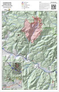
Closures and Evacuations: Grant County has issued a Level One evacuation advisory in the area of the fire. Level One means be ready and aware of fire conditions. You can view a map of the evacuation zone on the Grant County Emergency Management Facebook page. An expanded closure is in effect on the Malheur National Forest today. For complete closure information, please go to: https://www.fs.usda.gov/malheur
Smoke may be visible to nearby communities and Forest visitors. Smoke and air quality impacts within the state can be monitored by visiting: http://oregonsmoke.blogspot.com
Quick Facts:
SIZE: 4,136 Acres
CONTAINMENT: 10%
CAUSE: Lightning
PERSONNEL: 611
LOCATION: 19 miles north of Prairie City
FIRE INFORMATION:
541-625-0892
2022.crocketsknob@firenet.gov
FACEBOOK: https://www.facebook.com/CrocketsKnobFire
INCIWEB: https://inciweb.nwcg.gov/incident/8355/
TEMPORARY FLIGHT RESTRICTION
There is a Temporary Flight Restriction over the Crockets Knob Fire area. Wildfires are a No Drone Zone - if you fly, we can’t.

No comments:
Post a Comment
Note: Only a member of this blog may post a comment.